Just when you thought google maps was almost perfect, they went and added something else totally cool: Satellite photography. And of course google being google, you can drag the sat images just like you can the maps. Unlike Microsoft owned Terraserver which is arcane/buggy/ugly, this just works.
Super super cool. And it was all done using good old DHTML and not some proprietary MS garbage. Blogger Joel Webber did an excellent job figuring out how they did it.
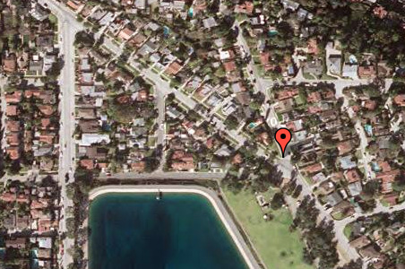
This is image of our old house in LA (the dot is actually on the corner, the house and pool are behind it). The detail is fantastic. Nice to see the old pool again and the shadow of the palm tree across the road. Gosh what I would give to have one of Jenn's organic meals made from vegetables from our garden.... Or a plum from our wonderful old tree... but I digress.
Comments:
They definitely could have gotten closer ... if you download Keyhole (google owned) they let you get way closer to the ground with higher resolution. I wonder if it wasn't a security risk?